Continuation of the article about Herføl
Below, you can read about swimming spots, the island's interesting flora, its famous son, maps, and practical information.
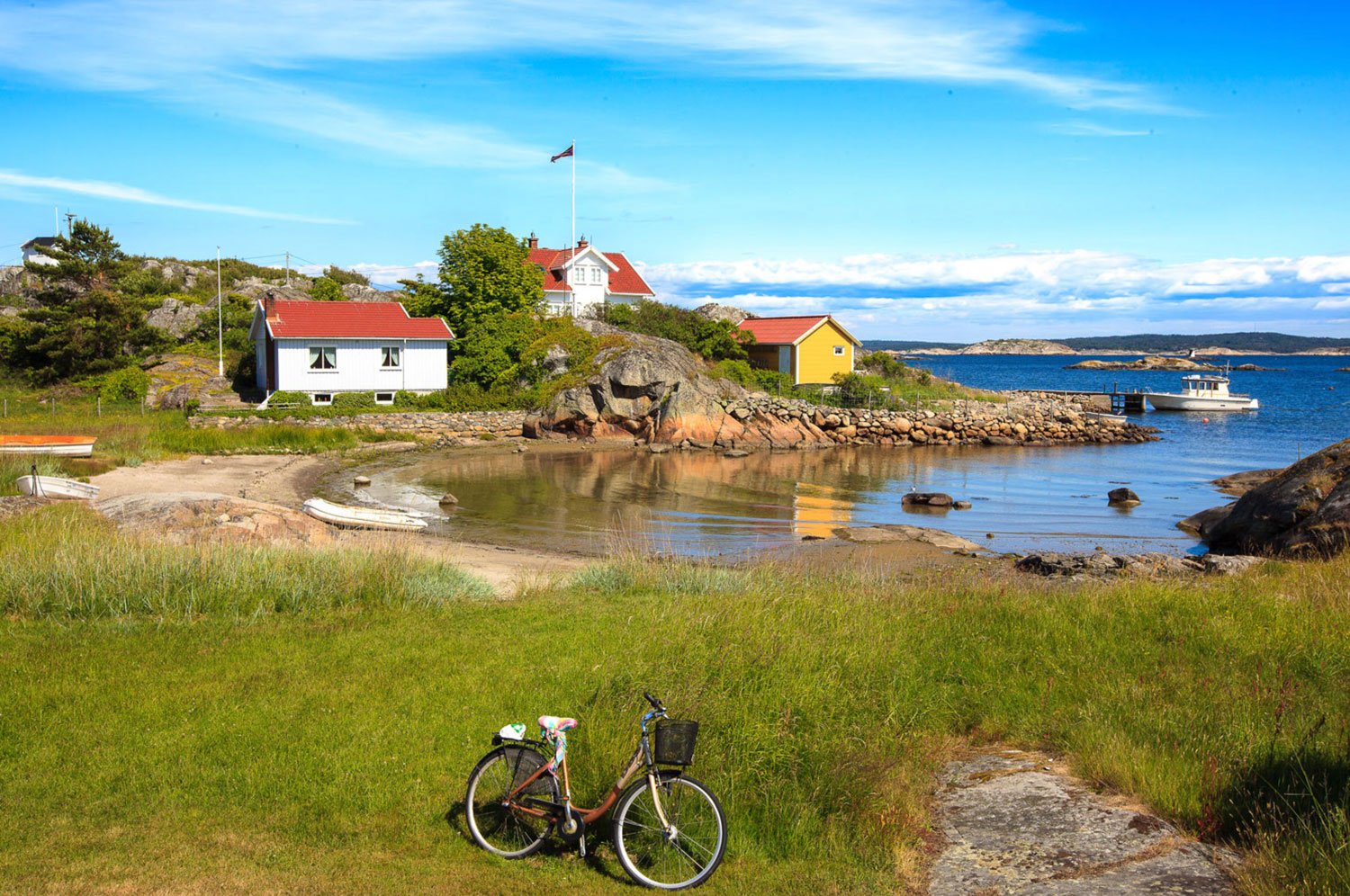
Image above: Stuthavna and Andholmen
The island's great son
Andholmen is located on the eastern side of Herføl and is a charming and idyllic place with a cluster of grand old houses and boathouses. This is also where the old customs station was located before it was closed in 1976.
Herføl's most famous son, Henry A. Larsen, was born in Andholmen on Herføl. Larsen was the first person to sail the Northwest Passage from west to east, and the first to complete the journey without overwintering along the way. He is famous in Canada for his achievements, yet remains relatively unknown in his homeland, Norway.
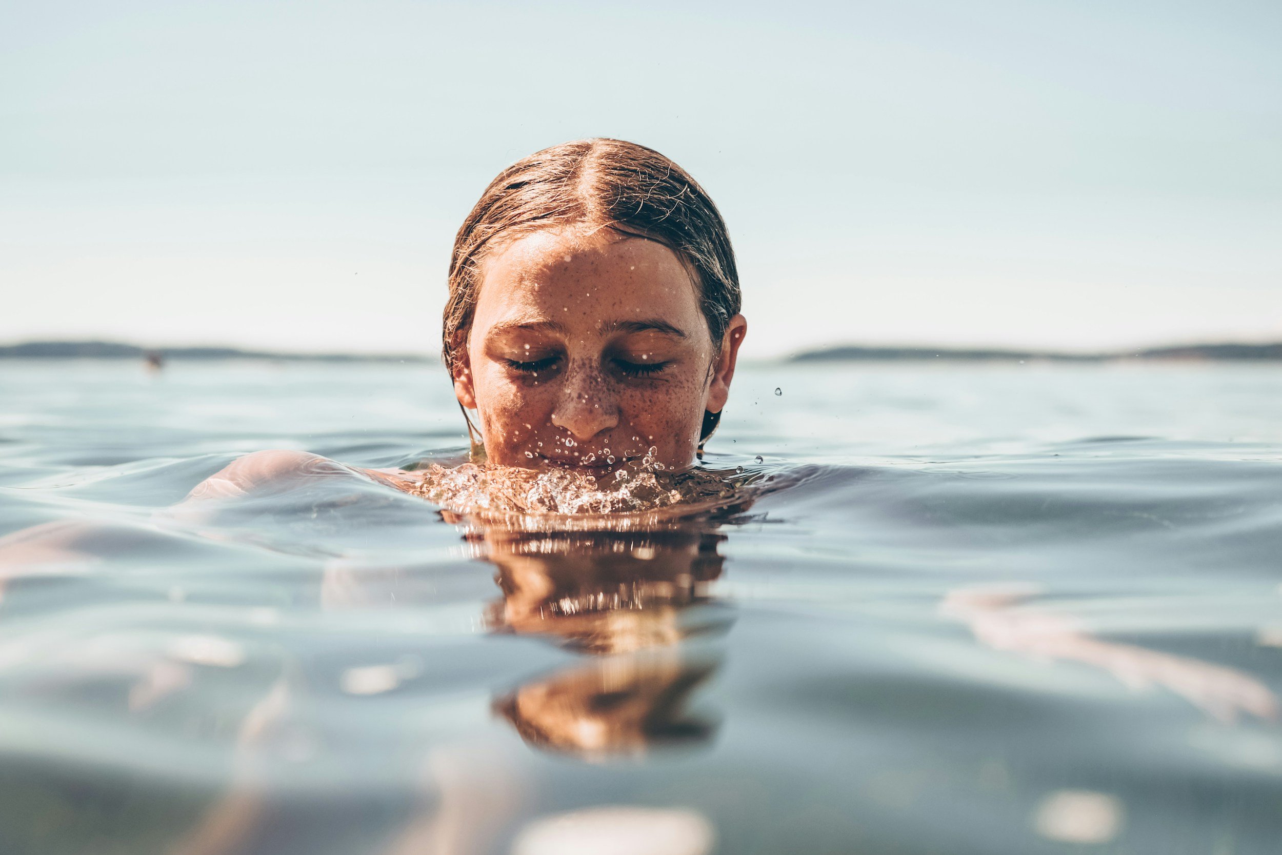
Swimming Paradise
Want to Swim on Herføl? Plenty of Options Await!
If you're looking for a place to swim on Herføl, you'll find many varied and inviting spots. With sparkling, salty, and refreshing water, it’s tempting to dive right in! Let’s take a tour around the island, starting in the east:
🌊 Tøftebukta – A small, sheltered northwest-facing bay with a sandy beach.
🏖 Stutehavna – Located to the south and east, featuring a landing pier and several small coves with sandy beaches.
🏝 Gyltebukta and Gylteholmene – Situated at the southeastern tip of the island, this is a Southern Norway-style coastal paradise with islets and skerries. It’s also a great spot for fishing.
📍 On western Gylteholmen, a cairn offers a fantastic view. Here, you’ll find the monogram of Swedish King Oscar II and the year 1904—just one year before Norway left the union with Sweden.
🏊 Stormona – A long sandy beach with a beautiful backdrop, flanked on both sides by sheltering rocky outcrops.
🏖 Grønnebauen – Located on the island’s west side, slightly northwest of Linnekleppen, Grønnebauen is protected from the southwest winds and features a lovely sandy beach.


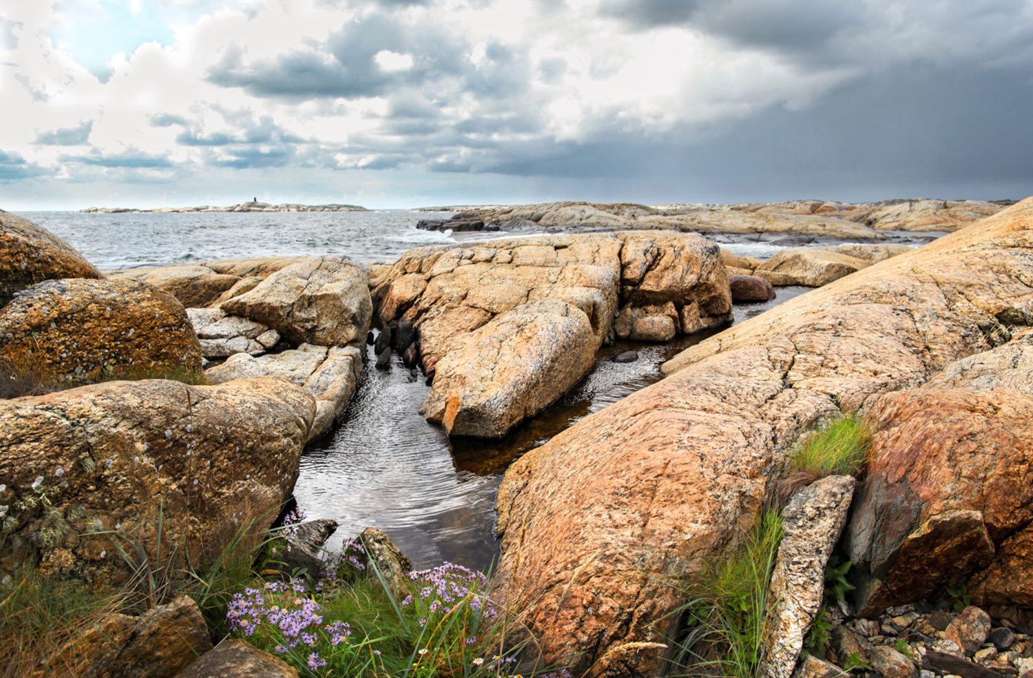
West of Grønnebauen, you'll find Svanetangen, a rocky paradise that is a favorite spot for many summer visitors to Herføl.
This area is home to many glacial potholes, some with incredibly unusual, almost sculptural shapes.
🌊 Kaffebukta – Located just 500 meters north of Grønnebauen, this small, idyllic spot features a grassy area, perfect for play and activities. Swimming here is best done from the smooth coastal rocks or via the diving board that is available.
⛵ Explore Herføl’s Archipelago by Boat
If you have your own boat, we highly recommend taking an exploration trip through Herføl’s archipelago. The west and north sides of the island are particularly rich in small islands and idyllic coves.
⭐ Must-visit spots include:
Fløyholmen, with its tiny "tropical beach."
Ekholmen, home to the ancient Hvaler ruins (Hvalertuftene).
📍 See the map below for more details on these locations.
No matter where you go on Herføl, a refreshing swim is never far away! 🏊♂️☀️


The island is teeming with beautiful beach scenery

One of the most fascinating aspects of Herføl’s nature is its rich flora. Despite parts of the island being rugged and exposed to harsh weather, it is home to diverse vegetation types and many rare plant species. The highest concentration of plant species can be found in the shell sand areas in the northwest of the island.

Gentianella uliginosa

Centaurium littorale, the seaside centaury, is a species of flowering plant belonging to the family Gentianaceae
There are two particularly valuable vegetation types on Herføl: red fescue coastal meadows and calcium-rich meadows. These areas are home to demanding plant species such as Seaside wormwood, Narrow-leaved sweetflag (Gentianella uliginosa), Dwarf gentian, Hartman’s sedge, and Marsh gentian (Centaurium littorale).
At Linnekleppstranda, you can find the nationally red-listed marsh fern.

Herfølsalta Nature Reserve
Herfølsalta Nature Reserve is located on the eastern side of Herføl, approximately 300 meters south of the Herføl ferry dock, stretching along the coastline towards Tøfte for nearly 500 meters. To the west, the coastal meadow area is bordered by tree and shrub vegetation.
The bay is dominated by marine deposits consisting of clay and shell fragments, with granite outcrops appearing as small skerries and islets both offshore and on land. The sea area is very shallow, with large sections exposed at low tide. The highest point in the reserve is about 4 meters above sea level.
Purpose of the Nature Reserve
The protected status of the area aims to preserve a habitat with endangered, rare, and vulnerable natural features, including:
A large and diverse coastal shoreline
Rare vegetation types
Shallow marine areas
The area is of significant importance for biodiversity, supporting several rare species and playing a crucial role in maintaining ecological balance.


The Coastal Meadow – One of the Largest on Herføl and Hvaler
The coastal meadow area on Herføl is the largest on the island and among the largest in Hvaler. The landscape is highly diverse, featuring tidal saltwater ponds that dry up during certain periods, exposed bedrock, and vegetation stretching into the shallow sea.
The vegetation is dominated by salt-tolerant plant communities, including saltmarsh grass-red fescue coastal meadow and bulrush-reed swamp. The "southeastern saltmarsh meadow" vegetation type is classified as "critically endangered" in Norway.
🌿 Rare and Notable Plant Species:
This area is home to several rare species, including:
Marsh gentian, dwarf gentian, red-topped lousewort, sea milkwort, and strawberry clover – all classified as "near-threatened" on the Norwegian Red List.
Narrow-leaved sweetflag – classified as "vulnerable" on the Red List.
Adder’s tongue fern – rare around the Oslofjord.
Additionally, various sedge species grow here, such as:
Blunt-flowered sedge, brown sedge, hare’s-foot sedge, grazing sedge, flea sedge, and mouse sedge.
🌾 In the moist meadow areas, you will also find:
Seaside bulrush, sea onion, round-fruited rush, marsh bedstraw, creeping saltweed, salt scurvygrass, and sea aster.
This rich coastal habitat is an important ecological site and a vital part of Herføl’s natural heritage.
Forest
Most of Herføl is grazed, yet the island is gradually becoming covered by forest. There is a significant amount of pine in the southern and central parts of the island, along with some spruce. The deciduous groves in the north primarily grow on formerly cultivated land.

The otherwise rugged and barren island of Herføl has some forest areas in its central part.
Powerful impressions and great memories
We conclude our journey of discovery on Herføl by walking the final stretch along the gravel road from Andholmen to the ferry dock at the Herføl marina. The first part of the road leads through a lush forest, and as the landscape opens up, we pass beautiful white houses surrounded by large gardens with fruit trees.


Plan Your Trip to Herføl
Herføl is the southernmost inhabited island in Hvaler Municipality, Østfold County, located near the border with Sweden. It is also Norway’s southeasternmost inhabited island.
The island has a total area of 1.96 km² and approximately 20 permanent residents. During the summer, the population multiplies as the owners of the 130 holiday homes arrive to spend their summer vacation on Herføl.
-
📍 Location: Herføl, Hvaler
📍 How to Get to Herføl
🚢 By Ferry:
Take the Hvaler ferry from Skjærhalden to Herføl.
The ferry schedule varies by season, so check VY or Østfold kollektivtrafikk for updated departure times.
⛵ By Private Boat or Kayak:
Herføl is ideal for boaters and kayakers, with many small islands, coves, and sheltered areas to explore.
Dock at Herføl Marina or anchor in a quiet bay.
🚗 By Car (to Skjærhalden):
Drive to Skjærhalden on Kirkøy, where you can park before taking the ferry.
Paid parking is available near the ferry terminal.
🏕 Accommodation:
There are no hotels on Herføl, but you can camp in nature or rent cabins and holiday homes on Herføl and the nearby islands such as Skjærhalden and Vesterøy. -
1. Hike to Hvaler’s Highest Point – Linnekleppen
🏔 On Herføl’s southwestern side, you’ll find Linnekleppen, the island’s highest point at 32 meters above sea level. It is marked by a 9-meter-high cairn (navigation marker). From here, you get a stunning view of the archipelago, and on clear days, you can see far out towards Skagerrak. The hike from the ferry dock to Linnekleppen takes about 30 minutes.
2. Explore Stone Age History
🗿 Herføl is home to several prehistoric cultural monuments, including Bronze Age burial mounds, which provide insight into the island’s long history of human activity.
3. Swim and Sunbathe on the Island’s Many Beaches
🌊 Herføl’s coastline features sandy beaches, pebble shores, and scenic swimming spots from islets and cliffs—perfect for a relaxing day of swimming and picnicking.
4. Go Kayaking or Take a Boat Trip
🚣♂️ With its location at the outer edge of the Hvaler archipelago, Herføl is an amazing destination for kayaking. Discover hidden coves, skerries, and lagoons that are only accessible from the water.
5. Hike to Svanetangen (about 25 minutes from the ferry dock) to admire the unique glacial potholes
6. Visit Herføl Kro and Enjoy Local Seafood
🍽 During the summer, you can visit Herføl Kro, where you can enjoy fresh seafood and local dishes in a cozy maritime atmosphere.
✨ Herføl is a true gem in the Oslofjord, offering a perfect mix of nature, history, and adventure!
-
Bring good shoes, as the trail can be slippery on the coastal rocks.
Bring binoculars to enjoy the ocean views and birdlife.
Enjoy a picnic at the top while taking in the breathtaking scenery.
Check the ferry schedule to plan your departure time. From the southernmost point of the island, it takes approximately 45 minutes to walk to the ferry dock.
🎒 Packing List for Herføl
✅ Comfortable hiking shoes (for rocky terrain)
✅ Swimwear & towel (for beach stops)
✅ Picnic & snacks (if not eating at Herføl Kro)
✅ Water bottle (limited refill options)
✅ Camera (to capture breathtaking landscapes)
✅ Sun protection (hat, sunglasses, sunscreen)
✅ Light windproof jacket (weather can change quickly)
HERFØL
County
Østfold
Municipality
Hvaler
Area
1.96 square kilometers
Herføl Latitude / Longitude
59.002 11.05683